

- News
- Reviews
- Bikes
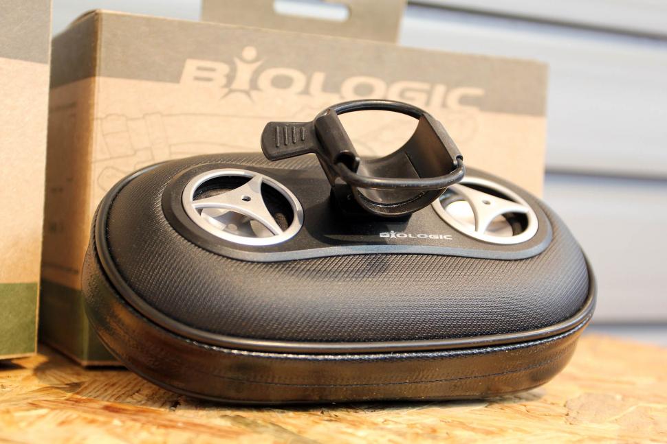
- Accessories
- Accessories - misc
- Computer mounts
- Bags
- Bar ends
- Bike bags & cases
- Bottle cages
- Bottles
- Cameras
- Car racks
- Child seats
- Computers
- Glasses
- GPS units
- Helmets
- Lights - front
- Lights - rear
- Lights - sets
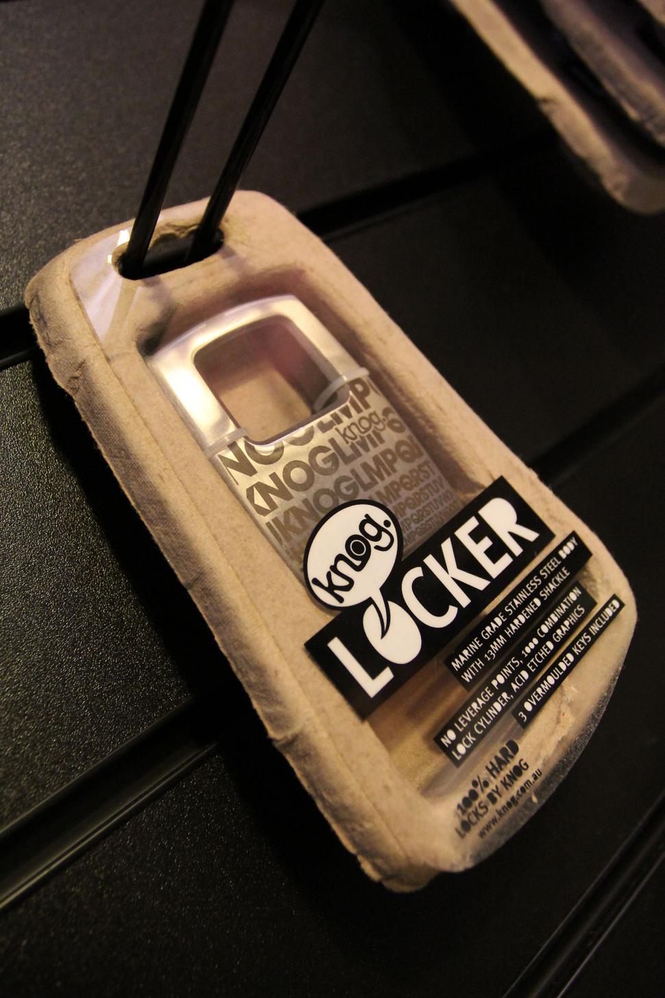
- Locks
- Mirrors
- Mudguards
- Racks
- Pumps & CO2 inflators
- Puncture kits
- Reflectives
- Smart watches
- Stands and racks
- Trailers
- Clothing
- Components
- Bar tape & grips
- Bottom brackets
- Brake & gear cables
- Brake & STI levers
- Brake pads & spares
- Brakes
- Cassettes & freewheels
- Chains
- Chainsets & chainrings
- Derailleurs - front
- Derailleurs - rear
- Forks
- Gear levers & shifters
- Groupsets
- Handlebars & extensions
- Headsets
- Hubs
- Inner tubes
- Pedals
- Quick releases & skewers
- Saddles
- Seatposts
- Stems
- Wheels
- Tyres
- Health, fitness and nutrition
- Tools and workshop
- Miscellaneous
- Buyers Guides
- Features
- Forum
- Recommends
- Podcast
TECH NEWS
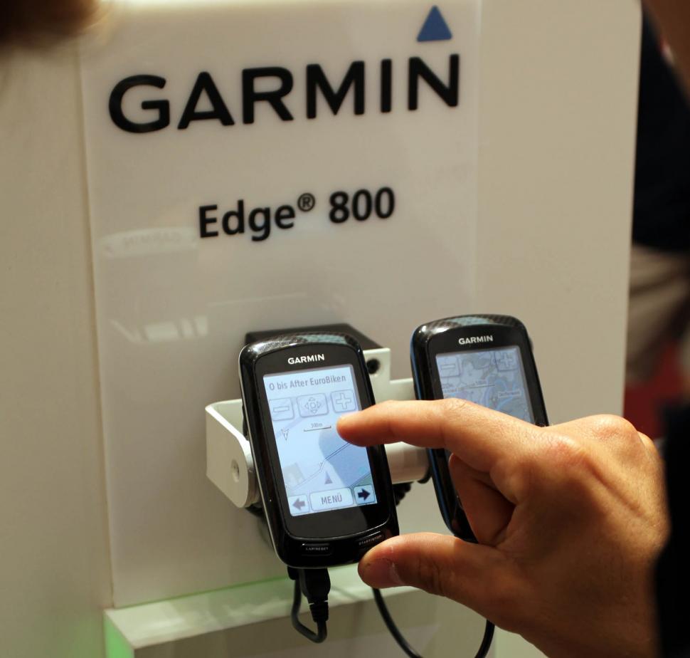


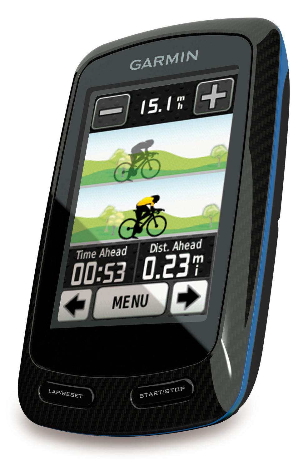


Garmin launch new Edge 800 GPS unit
Garmin have a big share of the bike GPS market, and for good reason: their units generally perform well, are well sealed against the elements and eke plenty of running time out of the battery. They've not always been the easiest to use however, and Garmin have been making strides toward a simpler system with the Edge 500.
The other thing that's been happening is the proliferation of map-based systems. The 705 was never very strong from a mapping point of view, and that's one of the main things that Garmin have addressed with their new unit, the Edge 800.
'The 705 was a bit ahead of its time and missed out on a lot of mapping functionality', Garmin told us. 'This new unit brings across all the performance benefits of the Edge 500 and adds in much better navigational capabilities than the Edge 705 could ever deliver. You could use this if you're a serious road data geek or for a week long tour. It's also much more suitable for off road riding in the UK because it can display OS 1:25k and 1:50k mapping.'
The biggest changes are the fact that the display is colour, and that it's a touch screen which gives you much easier access to the unit's functions. Those of you with a Samsung Galaxy or iPhone 4 might scoff a little at the screen's quality and resolution and you wouldn't want to watch movies on it, but the lower res means that it's a lot less power hungry and it's designed to be legible in the open air too. Battery life is a claimed 15 hours; Garmin told us that was a 'strong' 15 hours, which we'll take to mean that it actually does last for 15 hours... Garmin are also working with Power Monkey to produce a backup battery that should extend the life of the unit to 35 hours, enough for a week of riding.
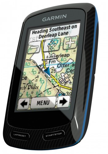
The unit is available for £349, or £399 with heart rate and cadence. For an extra £50 you get the whole of the UK at 1:50k scale on a micro SD card that slots in the back. The OS data is mapped to digital street data so that you can get turn by turn directions on the road. Garmin are providing a free route planning application for your PC that allows you to plan routes on the mapping that you have loaded onto the phone.
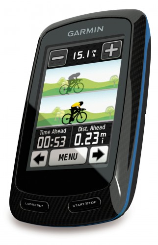
All the functions that 705 users are used to are there in more or less the same format, though the virtual partner has been spruced up a bit. We're off down to Southampton when we get back from Eurobike to have a go for ourselves, so we'll let you know what we think of it when we've had a chance to use it in anger.

Dave is a founding father of road.cc, having previously worked on Cycling Plus and What Mountain Bike magazines back in the day. He also writes about e-bikes for our sister publication ebiketips. He's won three mountain bike bog snorkelling World Championships, and races at the back of the third cats.
Latest Comments
- froze 1 hour 18 min ago
This was a very good listing of bikes for under 1,000....
- Hirsute 4 hours 39 min ago
Radar tells me their closing speed, if they are slowing and how far away. Then I decide to say a prayer. The change of light pattern is incidental.
- lonpfrb 4 hours 59 min ago
Quite so, which is why our village 20mph zone covers the whole residential extent. Of course, enforcement is another thing..
- lonpfrb 5 hours 25 min ago
No, that's very doubtful while proper testing would be fully destructive.
- don simon fbpe 6 hours 40 min ago
What's wrong with dropping down on to the Millenium Bridge, or the swing bridge, then the brief, but satisfying climb back up the hill? #training....
- chrisonabike 7 hours 20 min ago
The relatives might of course disagree, but in general I'd countenance a relatively light sentence* if only we could fix it so that those who...
- ktache 8 hours 17 sec ago
Id forgotten that I got a second hand set of project two's for my getting to work bike over twenty years back.
- Veganpotter 8 hours 57 min ago
My bet is that all these tires popping off are from people with bad pressure gauges or they're simply just putting too much air in on purpose. ...
- chrisonabike 10 hours 12 min ago
David9694 - you were right! These new autonomous vehicles really are conspiring to run out of control!...
Add new comment
6 comments
I'm with @DaSy on this.
It's a shame Garmin don't have the same standards in the software teams as they do on the hardware side.
There's not much on the 800 for happy 705 users to get too excited about.
BTW found this excellent review digging for more info:
http://www.dcrainmaker.com/2010/08/garmin-edge-800-in-depth-first-look.html
Lots of detail there, including a video of the screen working with gloves on:
http://www.youtube.com/watch?v=XsvL88NFCvs
...which is a trick you can't do with an iphone for example. This suggests that the screen isn't capacitative and so might not have water issues...I live in hope.
It'll be interesting to see if Garmin make a better effort of the units software than they have on the 705.
They have only just had to withdraw the software revision 3.2 because it has caused so many problems for 705 users. Their communication to users is dire too, as when I say they withdrew V3.2, it actually disappeared off their update site, and started to say that 3.1 was the latest. It is only the excellent Garmin forum that put up the issue, and also it relied on other users to work out how to downgrade to V3.1. Not a word from Garmin.
The hardware is great, really good, but there has never been any proper manual on how to use what is a pretty complicated user interface, the software has been full of bugs since I started using it several years ago.
I just wish they would sub out the software build to a company that can do it, and stick to making the great hardware that they are good at.
As you may have guessed, I am just a little frustrated at Garmin for how the users of the 705 have had to band together to work out how to use and maintain it.
And breathe.....
Touchscreen? In the wet?
The previous garmin efforts have been let down by fancy interfaces: the forerunner 405's touch bezel stops working in the rain (which it does a lot when I'm running) and the top of the edge 705's thumbstick snapped off, letting water in.
I'm in the market for this because of my busted 705, but a touchscreen? You really have to rain-test that bit in the review.
The other thing that needed fixed on the 705 was the ability to change the menus. The hours of my life I have wasted fiddling with the thumbstick to get 'Menu-(down 6)Where to?-(down 4)Find places-(down 4)Cities'...I want that on the top level...please tell me routing is a bit easier on this.
Really? how often do you use the garmin to go somewhere? i think ive used that feature maybe twice. Suppose i tend to know where im going most of the time or worked it out before habd if im going somewhere new (or uploaded a map to the device to follow).
Also, touchscreen in the wet? my iPhone one works fine when the screen is getting rained on or sweaty.
How often? Well, lets see now, the last 3 weeks I was cycling lands end-john o groats then home, I'd set it so I knew the distance to the places for coffee/lunch/dinner...thats 63 times right there, not even considering the times where I changed my goal. I wanted to have adjustable menus, not to impose my typical usage pattern on everyone.
But if you're not using the garmin to navigate, why would you even want the 705 or 800? The mapless models would do you fine.
If your iphone works in the wet you're very lucky, or not very wet. Have been in situations with both the 3G and 4 where I've had to access it in the rain and its awful. You can do stuff that just needs simple, broad strokes (like swipe it open, use the camera) but things like panning and zooming the map, typing in search boxes...you just get too many errors. Wiping the screen helps but in heavy rain you can't wipe fast enough.